Because context is everything, it is important to understand the geography of Algiers, and a little sociology, to understand the need for these bike lanes.
This is the general area of Algiers. It’s narrow and stretches along the river all the way across the Woodland Bridge. Believe it or not, there are cows in Algiers over the Woodland Bridge.
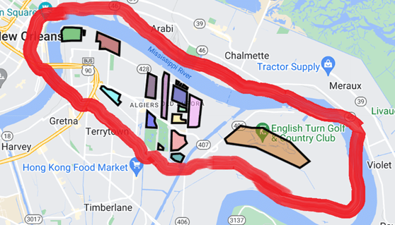
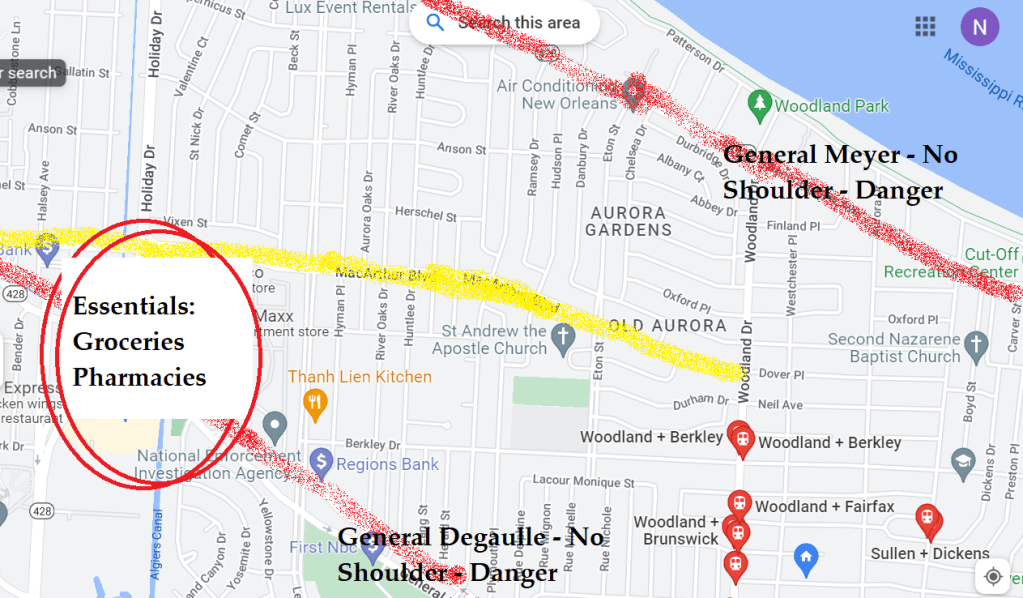
The map below map focuses on the more populated areas of Algiers. You can see what a member of Our Streets called the two main arteries—General Degaulle and MacArthur. Theses streets are the only way to reach pharmacies and groceries for many people coming from neighborhoods around the plaza. Advocates of protected lanes and people opposed to the safe streets design agree on the importance of these streets. Where the disagreement comes in is who should have access to them – because deciding how people can travel is, necessarily, deciding WHO can travel.
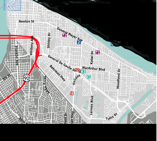
Newton, as depicted above helps link travel for cyclists from one end of Algiers to the other.
Below, is a closer look at the MacArthur corrider. As you can see, there is simply no way to take local streets other than MacArthur or General Degualle to get through Algiers from East to West. The smaller neighborhood streets are interupted by canals and housing developments. “You can’t get there from here.”
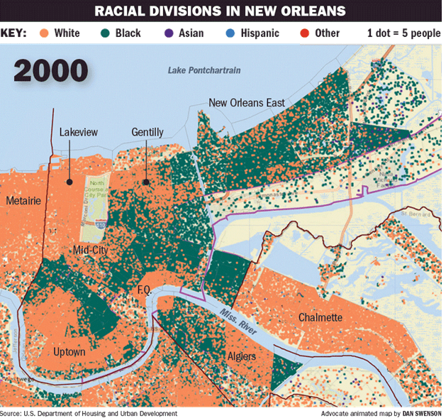
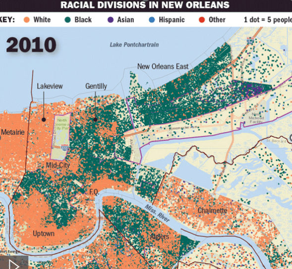
Below is the map that really speaks. It shows the changing make up of Algiers. A quick google search will give you more information about the history of Algiers and a practice known as redlining. The pinkish, orangish, square with “Algiers” on it, that’s where the bike lane cuts through. It links one edge of the wealthy box to the other.